
Historic Preservation, Environmental & Geospatial Services
Historic Preservation & Archaeology
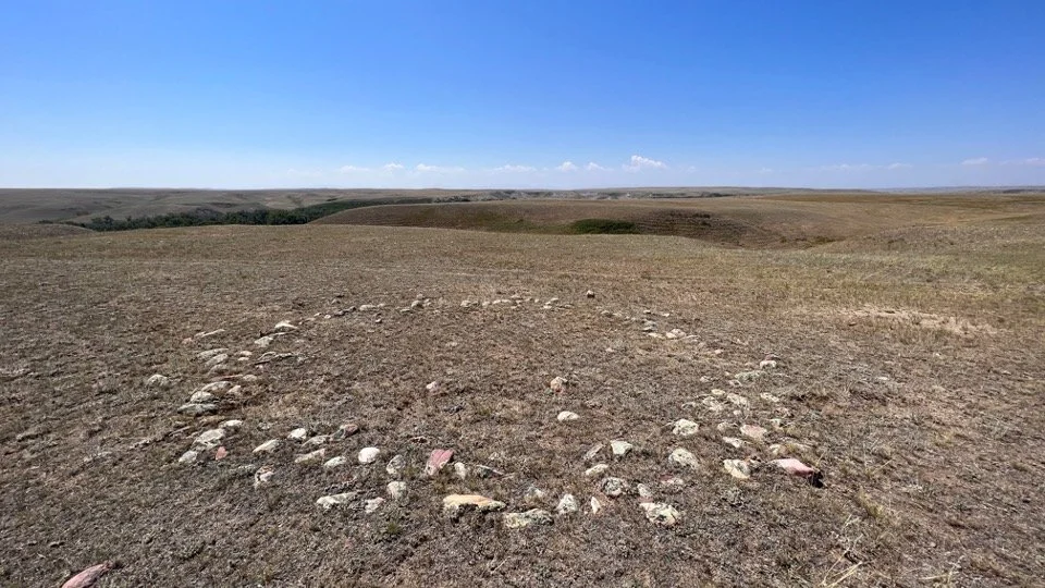
Old North Trail Partnership provides culturally informed compliance support under Section 106 of the National Historic Preservation Act (NHPA). A key advantage of our team is our extensive experience working directly with Tribal Historic Preservation Officers (THPOs), Tribal governments, and federal agencies to facilitate meaningful consultation, respect Tribal sovereignty, and support well-informed project planning.
We actively integrate the Section 106 and NEPA processes, recognizing that both require agencies to “stop, look, and listen” before making decisions that may affect historic properties, cultural resources, and the human environment. Through ongoing training and collaboration, our team stays current on regulatory requirements and best practices, allowing Old North Trail Partnership to deliver efficient, coordinated, and culturally grounded compliance solutions.
We can help with:
Class III Archaeological Surveys
Cultural Resource Site Documentation and Recording
Section 106 Tribal Consultation Coordination
Tribal Register Design
National Register of Historic Places (NRHP) eligibility criteria
Environmental
NEPA compliance may be required depending on a project’s scope and its potential environmental impacts. While many consultants rely on generic templates and one-size-fits-all mitigation, Old North Trail Partnership takes a tailored approach. We customize the NEPA review process to address the specific issues relevant to each project and develop practical, effective mitigation measures. Our goal is to provide an efficient and streamlined path through the process while delivering meaningful resource evaluations and thoughtful environmental considerations.
We can help with:
Environmental Assessments (EAs)
Tribal Forest Management Plans
Geospatial
Old North Trail Partnership provides advanced GIS services to support Tribal planning, cultural resource protection, and environmental decision-making. Our work includes high-quality mapping, advanced spatial analysis, and custom geodatabase development, all tailored to each Tribe’s priorities and data needs.
GIS strengthens Tribal sovereignty by supporting data ownership, protecting sensitive cultural information, and helping Tribes define, document, and preserve their cultural landscapes. Our GIS services support land use planning, resource management, infrastructure projects, climate resilience initiatives, and compliance with NEPA and NHPA—providing Tribes with secure, reliable, and culturally grounded tools for long-term stewardship.
We can help with:
Cultural Landscape and Traditional Use Area Mapping
GIS and geospatial services that document cultural resources and traditional use areas.
Geodatabase Design
Design tribally-owned databases for long-term cultural resources stewardship
Project & Compliance Mapping
GIS support for planning, consultation, NEPA/NHPA integration, and regulatory compliance.
Maps and Visualizations for Decision-Making
Custom cartography, map layouts, and data visualizations for reports, consultation, and public outreach.
